Swanzey Lake is a place that I visit quite frequently because of the easy accessibility of the surrounding forest. Like most lakes in this area there is a road that goes completely around it. Off this road, near a huge boulder covered with rock tripe lichens, is another road that I’ve wondered about for years. I was able to finally hike it recently.
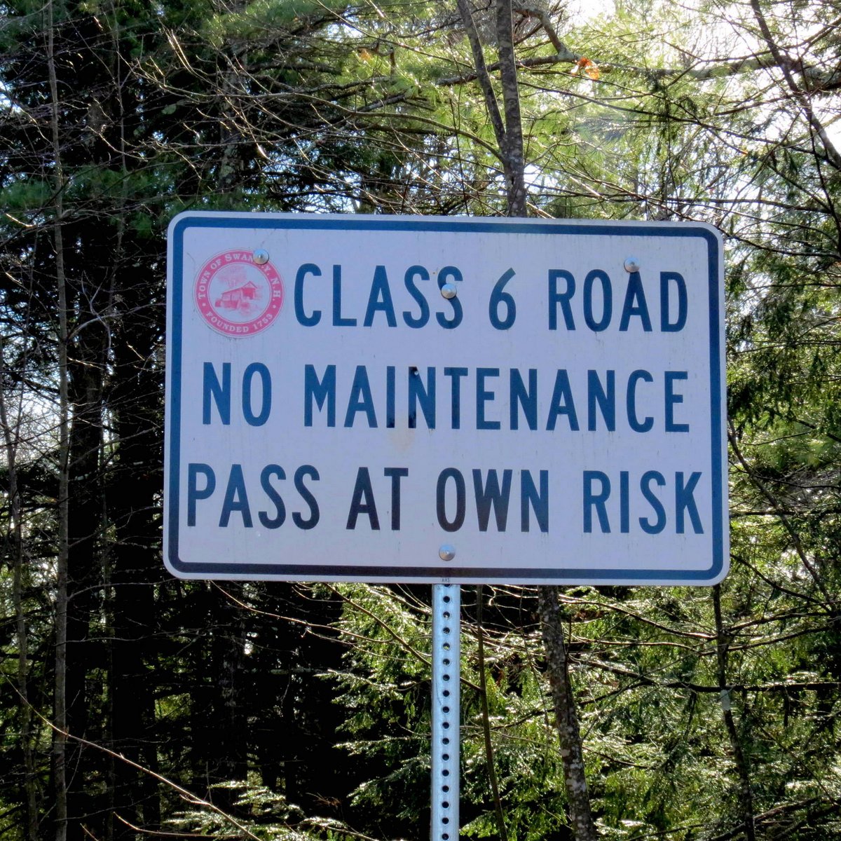
This is a class 6 road which means, unless you know someone who has traveled it, you’re better off walking it than driving it-at least for the first time. I know of another class 6 road with two old timber and plank bridges out and nowhere to comfortably turn around. I had no idea where this one might lead, but I was determined to find out.

It wasn’t long before I was regretting leaving the Yak Tracks behind, but as it turned out the icy spots were relatively easy to avoid. I’m not in a Yak Track frame of mind yet, but I’d better get in one soon. Some of these old roads just end in the forest and others connect with networks of other old, forgotten roads. There’s really no telling where they lead, and that’s part of the fun. Fun that is, as long as you carefully note any detours onto other roads that you might have to take. In some cases it’s possible to get seriously lost out here if you aren’t paying attention. I haven’t heard of any lost hunters yet but it usually happens every year at about this time.
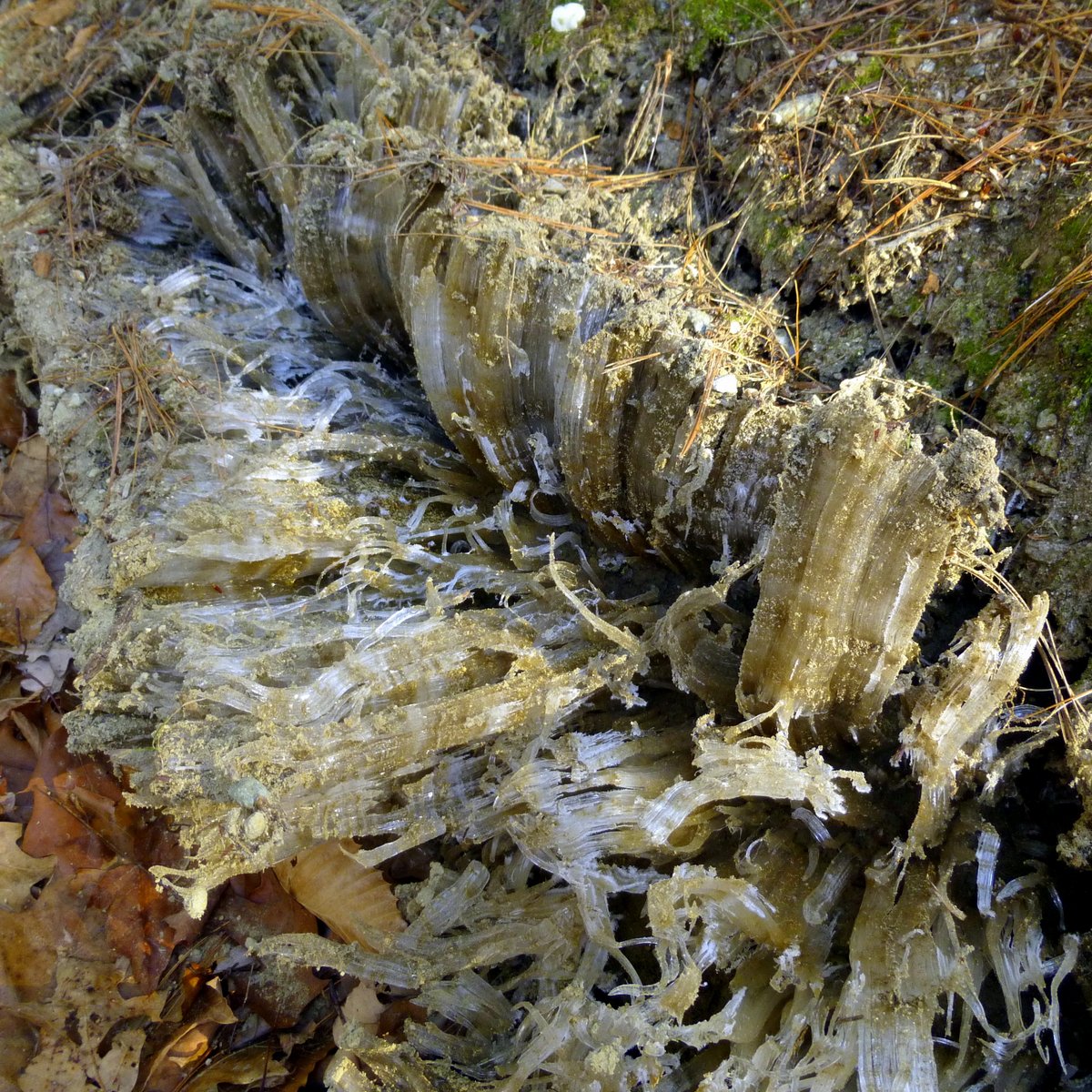
I saw the longest ice needles I’ve ever seen along this road. The ones in the photo were at least 6 inches long and had frozen together to form thick ice ribbons. Since they are extruded from the ground by hydrostatic pressure, they are almost always covered with sand or soil.

Instead of curling like they usually do these ice needles grew straight up and brought stones along for the ride. Several of these ice pillars were capped by tiny pebbles.
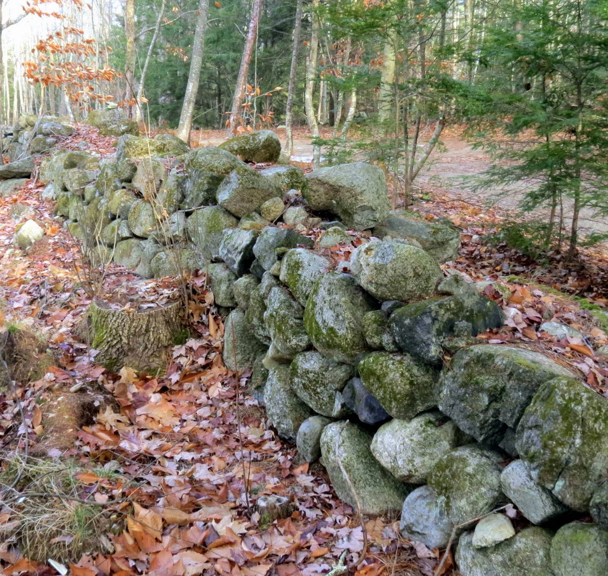
Stone walls mean this land was cleared once, and somebody lived out here. In 1822 the New Hampshire State Board of Agriculture suggested what farmers should do with all of the stones they found in their fields: “Almost all farms have stone enough to make a wall for every necessary division and enclosure. Labor used in this way answers a double purpose; it secures the fields from the ravages of stock, and improves them by removing rocks which are not only useless, but inconvenient and injurious in their natural situation. A farmer ought to consider it his proper business, as he has means and opportunity, to secure his lands by stone walls.” All he needed was a horse, a stone boat, and a strong back. And a couple of sons would have come in handy, too. By 1871 there were an estimated 252,539 miles of stone walls in New England and New York, enough to circle the earth 10 times at the equator. Today it is almost impossible to walk through these woods without finding them.
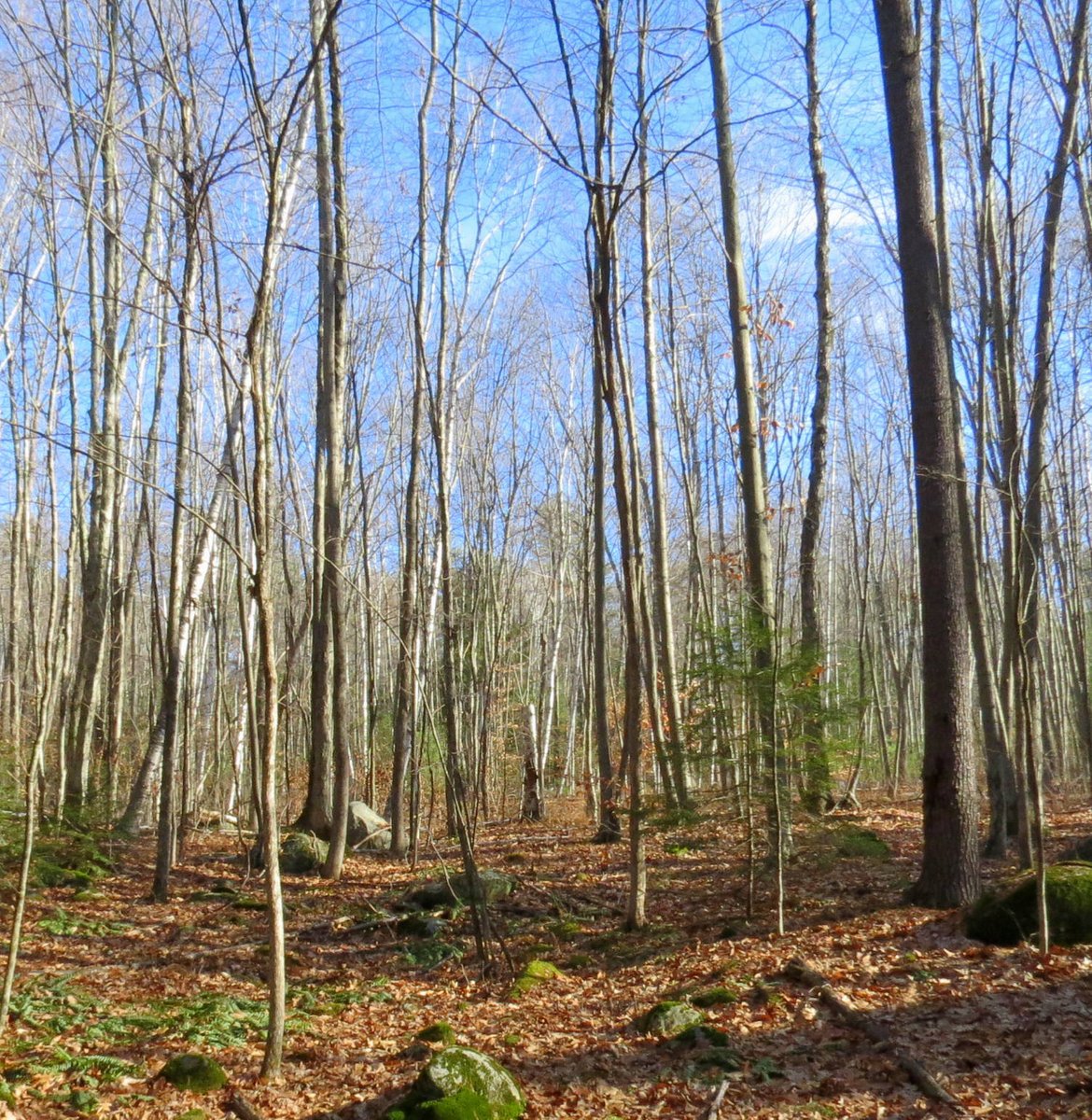
Somebody is still cutting trees here. None of these are very old and most are hard wood.
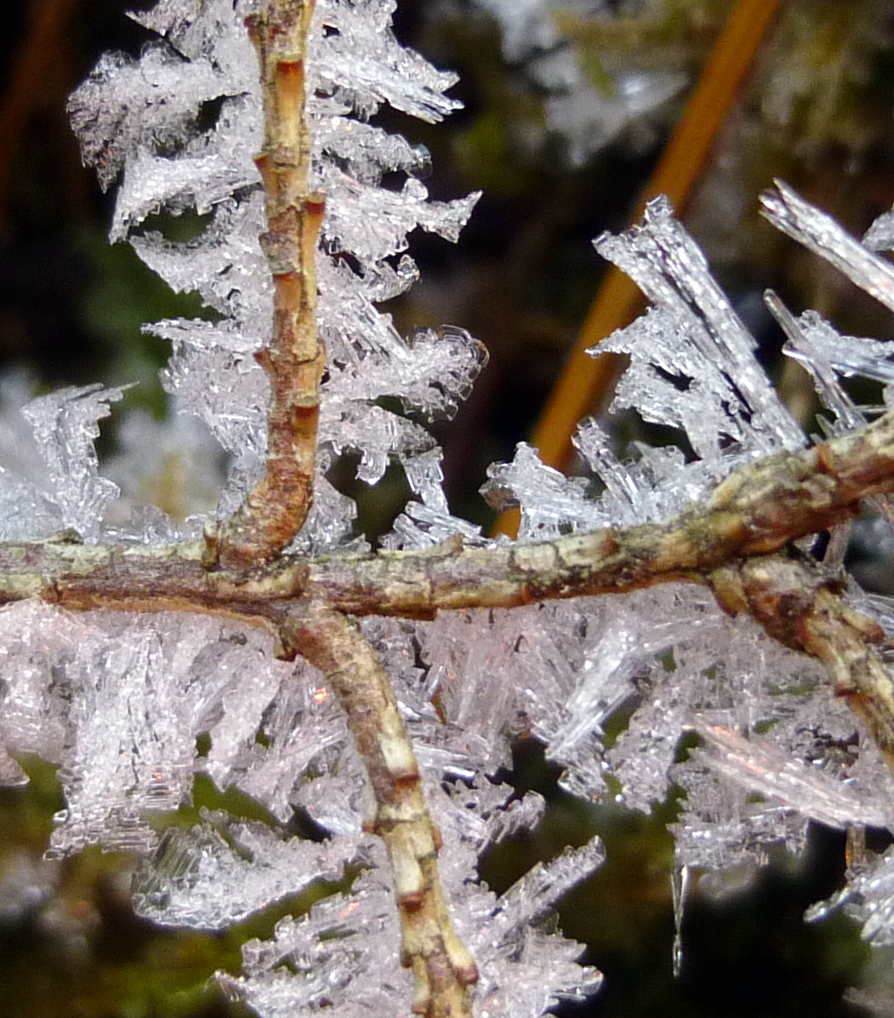 Almost every inch of this hemlock twig was covered in ice.
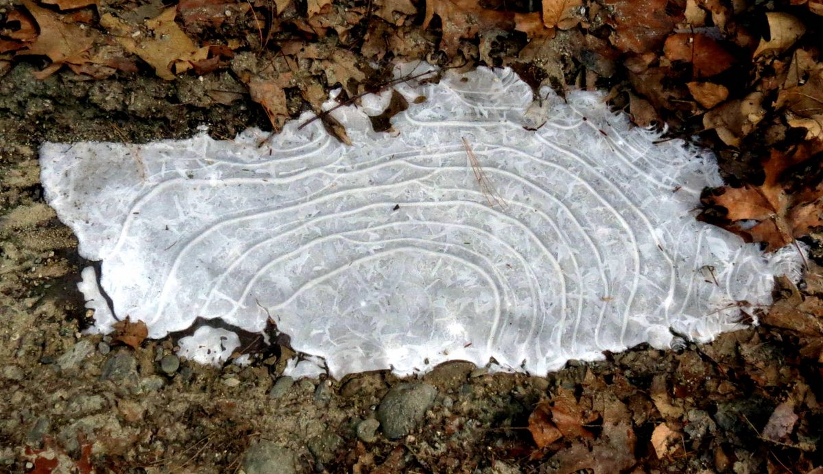
It must be wind that makes waves on mud puddles-even small ones-this one couldn’t have been a foot long.
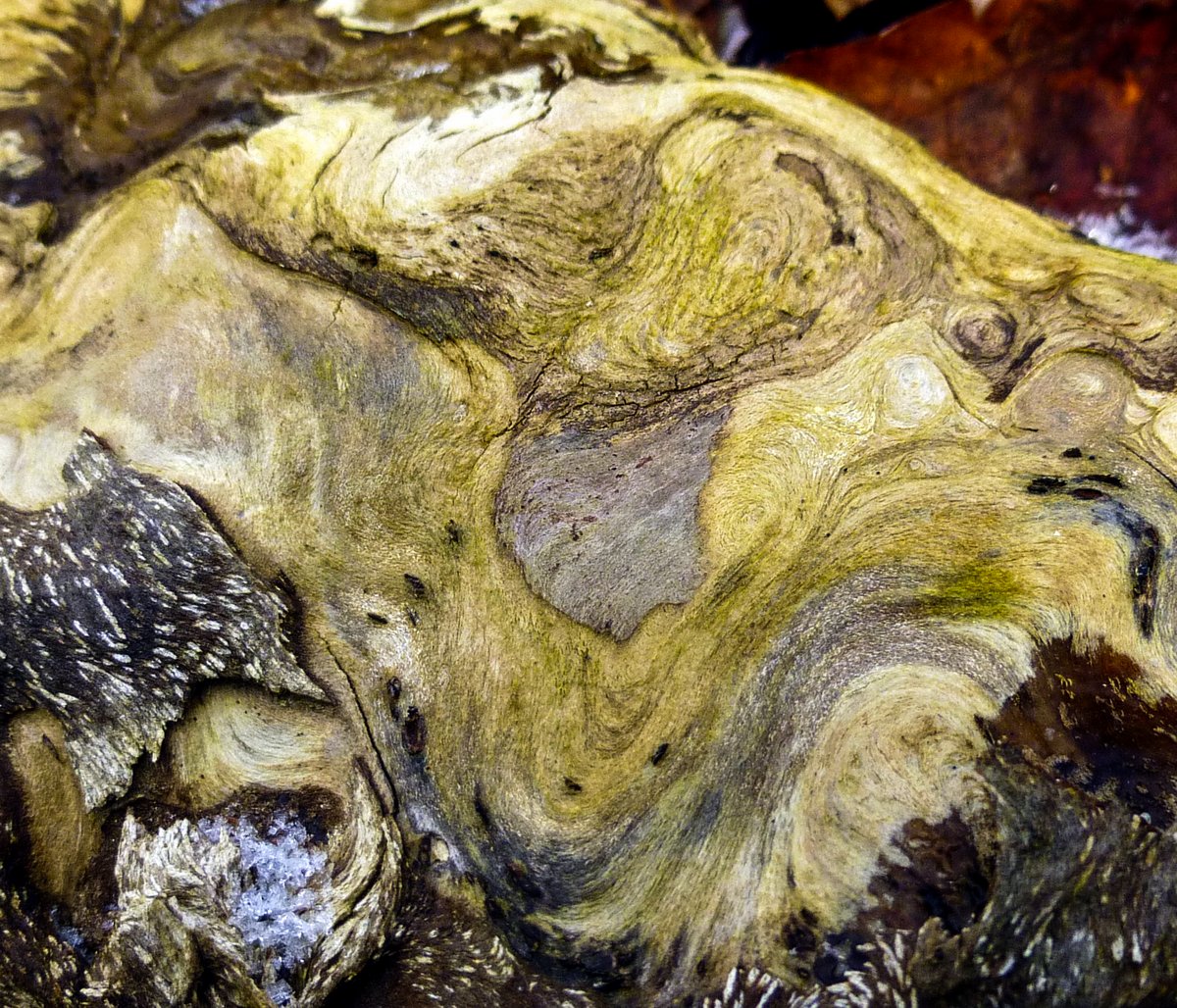
Puddles weren’t the only things displaying wave patterns. This fallen birch was as big around as a truck tire and might have made some interesting lumber. Spalting is a caused by fungi growing on dead trees and the wood is prized by woodworkers due to the unique colors and patterns that can form in the log. I was wishing that I could cut a slab or two just to see what the grain pattern would look like. This could be a very valuable log.
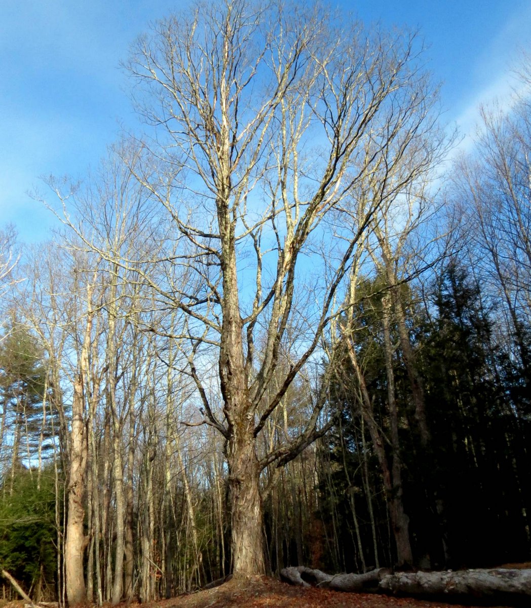
Next to the birch log stood a nice old sugar maple (Acer saccharum.) I don’t know why sugar maples are so often found near roads, but I’m guessing they were planted there so the sap buckets would be easier to get to. A paper titled Relationships between Soil Salinity, Sap-Sugar Concentration, and Health of Declining Roadside Sugar Maples by Graham T Herrick says that scientists all over the country are seeing dying sugar maples along roadsides. Road salt residue in soil inhibits plant water uptake and tips of branches in the crown start dying off. Before long the entire tree is dying. The strangest part of the study shows that the amount of sugar in the sap actually increases as the tree dies. The tree in the photo has probably never seen salt used on this old road, so it has had a chance to live a long, healthy life.
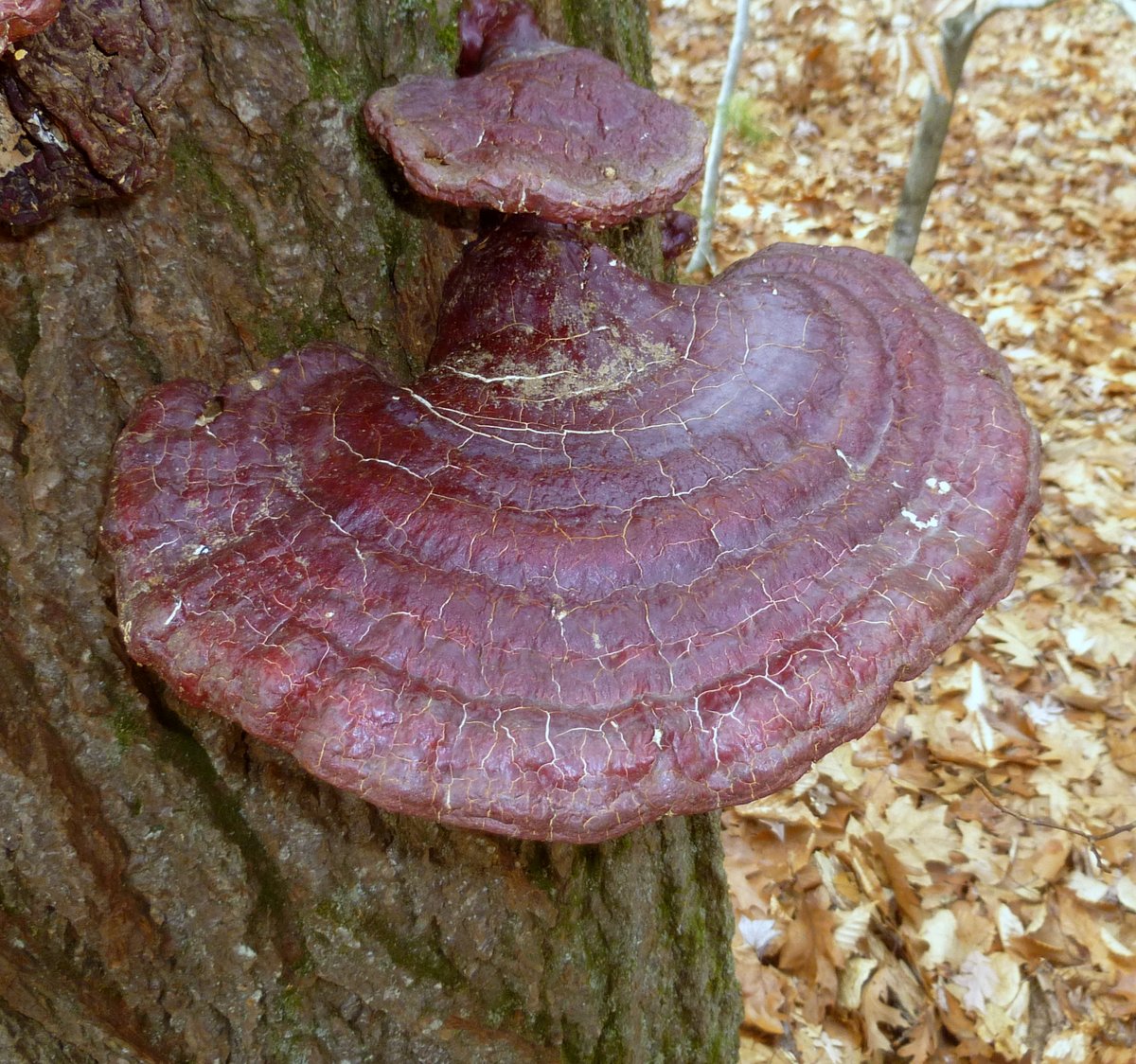
I found several hemlock varnished bracket fungi (Ganoderma tsugae) growing on an old eastern hemlock stump (Tsuga canadensis.) It has a white outer edge and underside when it is young and looks very different than those in the photo. They are annuals that grow new from the mycelium each spring, and these examples were at least a year old, I think. This mushroom is said to be among the most valuable medicinal fungi. The Chinese have used it in their medicine for over 2000 years.
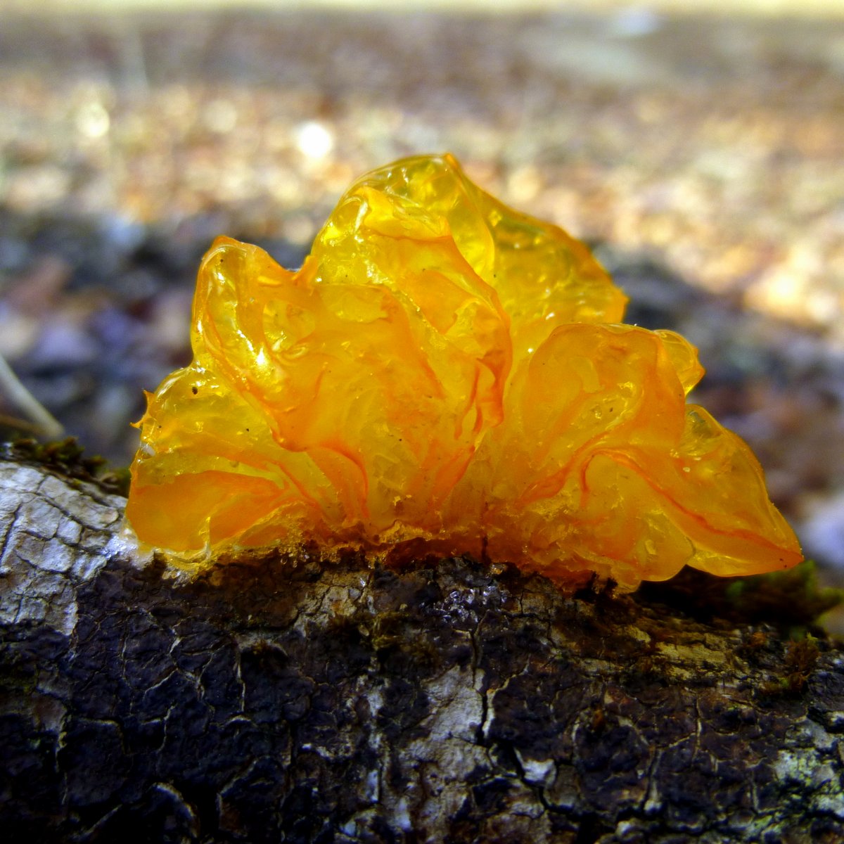
It was cold enough to freeze this orange jelly fungus but the sun must have thawed it out.
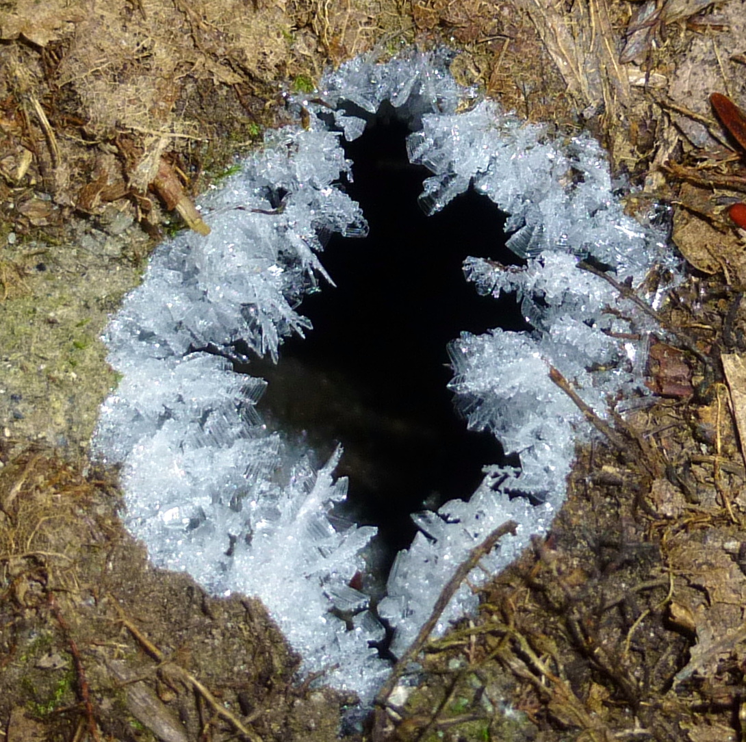
This hole in the ground was about as big as a quarter-just right for a snake. Judging by the hoar frost around its rim there was plenty of moisture of coming out of it. At this scale it looks like a cave.

I won’t be leaving those Yak Tracks behind again until March, I guess. Snowmobile and four wheel drive clubs do a great job of keeping these old roads open, but there’s nothing they can do about the ice.

Suburbia. Not exactly the wilderness I was hoping for and not what I was expecting to find at the end of a class 6 road, so back I went the way I came. At least now I don’t have to wonder where this road leads and I know where I can go for a short walk that has plenty of interesting things to see.
An old road always looks richer and more beautiful than a new road because old roads have memories. ~ Mehmet Murat ildan
Thanks for coming by.

Loved the old stone wall! Imagine the history it has seen…
Yes, if only they could speak. You have to admire the people who worked so hard to clear the fields and build them.
That orange jelly fungus really does look like a glop of marmalade, I wouldn’t mind a few of those stones, though that kind of stone wall isn’t very Midwestern.
If you need stone, this is the place to find it! I imagine your wall stone there must be a lot flatter-probably from ledge. Chances are it’s probably something other than granite, probably sandstone of bluestone, I’d guess.
Very cool trip! I have been making abstract photos for online stores and learning to share the CHILL 🙂 Have a great weekend stay safe in the snow. I might have to hit the beach 🙂
Thanks! That sounds like a good way to make some extra money. I hope you have a safe and warm weekend as well. The beach might be the only place that doesn’t see snow.
That is my thinking 🙂
I cant resist a new path either which may explain why I get lost so much. You certainly have more ice than we do, although we have had very mild weather so far this year. I love the ice needles growing out of the ground and the crystals growing on the branches but I’m not sure I’d like the cold that goes with them so much. The jelly fungus looked like amber and the frozen hole looked like a quartz crystal.
Getting lost here at this time of year could be serious business, but that magic phone of yours could probably get you out of it. Maybe it’s your turn for a mild winter. We had ours about 3 years ago. Glad you liked seeing the ice!
Fascinating post! I enjoy your photos, and information! Each time I learn something.
Thanks Montucky!
It occurred to me while reading this post and the comments how difficult it could be to keep from getting turned around in the areas where you roam. I took it for granted that there would be a Forest Service map covering the whole area as there are here, not realizing that there isn’t that much National Forest land there. I would have to re-think my entire navigation strategies were I to explore there! (I own a GPS but have such a deep-seated distrust of them I find only a few uses for it and trusting my life to one isn’t included.)
You hit that nail on the head-one of the things that I found most disturbing about getting lost in the woods was how easily it happened, and I was more used to being in the woods than out of them. One minute I knew exactly where we were and the next minute I had no idea, and I’ll never forget that feeling.
I don’t think I’ve ever seen a Forest Service Map but I’ve used, and still use topographical maps. The road in this post, like most class 6 roads, appears on a topo map as just a line, with no name or any other way to identify it, so you’re kind of flying blind when you travel these old roads.
When I’m going into territory I’ve never been in I use a GPS to record my track, and then if I can’t find my way back I can use the GPS and follow the track back to where I came from. Like you, I don’t trust them completely and still like to know which way north is and which side of my face the sun is shining on when I hit the woods. You don’t get many second chances in the woods so the GPS is really just a back up in case I do get lost.
I also use it to map where I’ve been so when I get home I can overlay my trail onto a topo map, which is interesting and a fun way to keep track of all your hikes. It also keeps a record of elevation change, which is interesting.
I do use the GPS for drawing a map of where I go and then highlight it on my USFS map later. The elevation information from the GPS is exact and sometimes that helps to orient me on a map. I also study my map before going on a hike and in the more difficult areas I will also use a topo map. And I carry two compasses.
I wouldn’t be without topo maps and a compass, and I also spend quite a bit of time researching the area I’m going into ahead of time if I’m not familiar with it. It’s nice that the GPS has a compass built in but it’s only as good as its batteries, so I always carry spares too.
It is fun walking just to see where you end up but doing it when it is so cold is very brave.
Or very dumb, I haven’t figured that out yet. I don’t mind cold but it can get bitter cold here-so cold that breathing the icy air in can be painful. That is the cold I don’t venture out into very often if I can help it.
It’s quite obvious why you hike so often, and I’m so glad you share each experience
Thank you. It’s fun sharing so I’m glad you enjoy these posts.
Yup, it’s certainly time for Yak Tracks! I really enjoyed this little walk through the woods, and all the interesting sights along the way. Do you use a GPS unit? I could see how some one could get lost, it happens here in Michigan every year during deer season.
Thanks Jerry. I do use a GPS now, but I got really lost in the woods one time years ago and I’ve never forgotten it. That was before cell phones and GPS units, so you were on your own. Somehow I found my way out and I’ve warned people about how easy it is to get lost ever since. I’ve heard about people over the years who never did find their way out.
You provide a wonderful vicarious experience. I’m kind of done walking right now — too darn cold.
Thanks Sue. I’ve heard that you’re in the deep freeze out your way, but it has to warm up eventually. We’ve been cold here too but nothing like you’ve seen yet.
I tend to find myself on a lot of class 6 roads! Great images of all if the different ices. I’m cold just looking at it! I have often commented about how many miles of stone walls there must be. I knew it had to be a lot, but I didn’t think is would be that much. Interesting quote from the. NH State Board of Agriculture
I was just telling Martha that if I had a Jeep, I would too. It was mighty cold that morning, so ice was everywhere. I was surprised by the miles of stone walls too, and that was in less than 50 years from the board of Agriculture’s instructions. It must be a lot more by now.
Alan, loved your information about stone walls. I had a friend from Texas visit recently and she commented on all our “rock fences” in New England. The plight of the sugar maples is sad, so glad you found one that was untouched by the road salt.
I love the idea of following the Class 6 roads. They fill me with questions; who made them originally? Why are they no longer in use? What did they look like and what views did they provide when they were first built? Laura from touringnh.com often takes me out in her Jeep and is fearless about driving down these mysterious lanes.
As always, I learned something and thoroughly enjoyed the journey.
Thank you Martha. I have all those questions about these roads as well, but there are very few answers, I’m afraid. I assume that they were abandoned because better roads were built, but I don’t even know that for sure. Some of them also most likely lead to farms that are no loger there. That was my thought when I found the sugar maple.
Riding around with Laura sonds like fun! If I had a jeep I’d drive down more of these roads because Jeeps are short enough to be able to turn around just about anywhere. A pickup truck needs a lot more space.
This was delightful to read and see your photos. I recently found your blog and learn something new every time I read a post! Here in NW Montana, we have 10″ of fresh powdery snow that followed 10 days of sub-zero temps. I use my YakTrax every day now! 🙂
Thank you Diana, and welcome! It sounds like great skiing out your way. I’d be using my Yak Traks too though, because I don’t ski. Thanks again for visiting and commenting.
Reblogged this on Writing Out Loud and commented:
New Hampshire Gardens writer always has great photographs with description, but this piece has added suspense.
Going to reblog this one. You have taken you writing to a new level. Why? For me it was because of the suspense. Great column.
Thank you. I wasn’t thinking about suspense whe I put it together, but I guess there must be some at that.
What an interesting walk, glad you could do it at last. Loved the icicles.
Thank you. I’m glad you enjoyed it.